- Destinations
- Routes
- Events
About Roque Teneguia
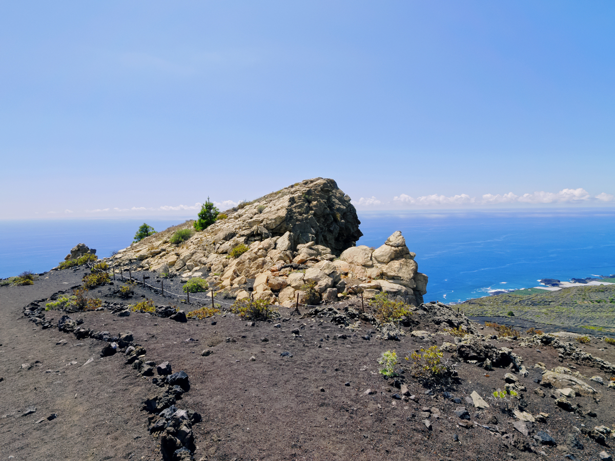
In the southern part of the island of La Palma the Roque Teneguía is located, on the southwestern slope of the San Antonio volcano belongs to the municipality of Fuencaliente.
The Roque de Teneguía has a height of 400 meters above sea level and is known as one of the most important geological formations of the municipality. One of the most important elements that has the Roque de Teneguía are the Auarite rock engravings that is located in the area. These vestiges give a good account of the interesting history that surrounds not only the Fuencaliente area, but the entire island of La Palma. It can also observe petroglyphs, (symbolic designs that have been engraved on the surface layer of the rock) spiral or labyrinth and serpentine lines that some experts attribute to the action of water.
In addition to this prehistoric element, the Roque de Teneguía is also interesting and has a certain botanical importance, here the Cabezuela or Cetaurea Junonia.
El Roque is a very old phonolite structure about 600,000 years old and has a characteristic pale yellow color. It is curious that you can see remains of the last eruption that took place in 1971.
| Formats | jpg, png, gif, bmp |
| Maximum size | 10 MB |
| Width and minimum height | 150 px |
| Maximum width and height | 16000 px |

Hiking route through La Palma leaving from El Pilar Refuge until you reach the Fuencaliente lighthouse. They will travel for just over 23 km. several volcanic summits and lookouts as well as crossing the Dorsal del Cumbre Vieja. The difficulty is high and due to the intense heat during the summer, it is advisable not to do it during the months of July and August.
The Gastronomic Route of the Volcanoes is a route of different bars and restaurants that promote each year towards the month of September, with special dishes, the gastronomy of La Palma
Share your experience
Do you know him?